

Political Shades 3D Map of Democratic Republic of the Congo, lighten
This is not just a map. It's a piece of the world captured in the image.
The 3D political shades map represents one of many map types and styles available. Look at Democratic Republic of the Congo from different perspectives.
Get free map for your website. Discover the beauty hidden in the maps. Maphill is more than just a map gallery.


Base Map
- flag52

National flag of the Democratic Republic of the Congo resized to fit in the shape of the country borders.
- satellite30

Satellite map shows the land surface as it really looks like. Based on images taken from the Earth's orbit.
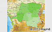
- physical29

Physical map illustrates the natural geographic features of an area, such as the mountains and valleys.
- shaded relief29

Shaded relief map shows topographic features of the surface. Hill-shading simulates the shadows cast by terrain features.
- political28

Political map illustrates how people have divided up the world into countries and administrative regions.
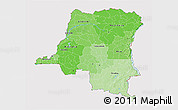
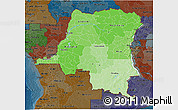
- political shades27
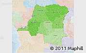
Political shades map use different shades of one color to illustrate different countries and their regions.
- classic style2

Classic beige color scheme of vintage antique maps enhanced by hill-shading. Democratic Republic of the Congo highlighted by white color.
- gray2

Dark gray color scheme enhanced by hill-shading. Democratic Republic of the Congo highlighted in white.
- savanna style2

Savanna green color scheme enhanced with shaded relief. Democratic Republic of the Congo is highlighted by yellow color.
- silver style2

Light grey color scheme enhanced with shaded relief. Democratic Republic of the Congo highlighted in white.
Outside
- political shades17
Political shades style for all areas outside of the borders of Democratic Republic of the Congo.
- single color4

All areas outside of the borders of Democratic Republic of the Congo filled with a single color.
- satellite2

Satellite style for all areas outside of the borders of Democratic Republic of the Congo.
- shaded relief2

Shaded relief style for all areas outside of the borders of Democratic Republic of the Congo.
- cropped1
All areas outside of the borders of Democratic Republic of the Congo cropped from the image.
- physical1
Physical style for all areas outside of the borders of Democratic Republic of the Congo.
Effects
- land only8

Selected effects applied to the land only, water areas remain unaffected by the effects.
- darken6
All areas outside of the borders of Democratic Republic of the Congo darkened.
- desaturated6

All areas outside of the borders of Democratic Republic of the Congo desaturated to grayscale colors.
- lighten6

All areas outside of the borders of Democratic Republic of the Congo lightened.
- semi-desaturated6

All areas outside of the borders of Democratic Republic of the Congo partly desaturated to almost grayscale colors.
Options
- bathymetry sea6
Bathymetry shows underwater depth of the ocean floor using colors and tinting.
- hill shading inside6
Base map enhanced by hill-shading.
- hill shading outside6
Outside map enhanced by hill-shading.
- shaded relief sea6
The depth of the waters represented by colors and enhanced by relief shading.
Maps of Democratic Republic of the Congo
Maphill is a collection of map images. This view of Democratic Republic of the Congo at an angle of 60° is one of these images. Click on the Detailed button under the map for a more comprehensive map.
See Democratic Republic of the Congo from a different perspective.
Each map style has its advantages. No map type is the best. The best is that Maphill enables you to look at the same country from many different angles.
Sure, this political shades 3D map is nice. But there is good chance you will like some other styles of Democratic Republic of the Congo map even more. Select another style in the above table and look at the Democratic Republic of the Congo from a different view.
What to do when you like this map?
If you like this Democratic Republic of the Congo map, please don't keep it to yourself. Give your friends a chance to see how the world converted to images looks like.
Share this map.
Use the buttons for Facebook, Twitter or Google+ to share a link to this Democratic Republic of the Congo map. Maphill is the largest map gallery on the web. But the number of maps is certainly not the only reason to visit Maphill.
Get free map of Democratic Republic of the Congo.
You can embed, print or download the map just like any other image. All Democratic Republic of the Congo 3D maps are available in a common image format. Enrich your website or blog with hiqh quality map graphics.
Free images are available under Free map link located above the map.
Is there anything more than this map?
Sure, there is. It has been said that Maphill maps are worth a thousand words. That's certainly true. But you can experience much more when you visit Democratic Republic of the Congo.
Be inspired. Visit Democratic Republic of the Congo.
Democratic Republic of the Congo has a lot to offer and a lot to see. It is not possible to capture all the beauty in the map.
Democratic Republic of the Congo hotel deals.
If any of Maphill's maps inspire you to come to Democratic Republic of the Congo, we would like to offer you access to wide selection of hotels at low prices and with great customer service. Best price is guaranteed.
Thanks to our partnership with Booking.com you can take advantage of up to 50% discounts for hotels in many cities and regions of Democratic Republic of the Congo. Compare hotel prices, book online and save money.
Democratic Republic of the Congo hotels
See the full list of destinations in Democratic Republic of the Congo, browse destinations in Africa or choose from the below listed cities.
Hotels in popular destinations in Democratic Republic of the Congo
Learn more about the map styles
Each map type offers different information and each map style is designed for a different purpose. Read about the styles and map projection used in the above map (Political Shades 3D Map of Democratic Republic of the Congo, lighten).
Political shades map
Political shades map is similar to a political map, however different regions are represented by the tints and shades of the same color, not by different colors. The purpose of a political map of Democratic Republic of the Congo is to provide information about how people have divided up the world into countries and administrative regions.
Different colors distinguish highest level divisions, their sub-regions are coloured by various shades of the same color. The choice of the color for countries and regions is random.
Plate Carree map projection
A map projection is a way how to transform points on a Earth to points on a map. This 3D map uses Plate Carree projection, a simple variant of the equidistant cylindrical projection originated in the ancient times. The parallels and meridians are equally spaced, they together form equally sized squares over the entire world map.
Using simple grid, where each cell has the same size and shape, brings in significant benefits. For comparison, the detailed maps of Democratic Republic of the Congo use Mercator projection instead. The Mercator projection preserves the shapes and angles of small areas better, but on the other hand, it significantly distorts the size of areas.
Facts
Popular searches
A list of the most popular locations in Democratic Republic of the Congo as searched by our visitors.
The Maphill difference
It's neither this political shades 3D map nor any other of the many millions of maps. The value of a map gallery is not determined by the number of pictures, but by the possibility to see the world from many different perspectives.
Technology
We unlock the value hidden in the geographic data. Thanks to automating the complex process of turning data into map graphics, we are able to create maps in higher quality, faster and cheaper than was possible before.
Forever free
We created Maphill to make the web a more beautiful place. Without you having to pay for it. Maphill maps are and will always be available for free.
Real Earth data
Do you think the maps are too beautiful not to be painted? No, this is not art. All 3D maps of Democratic Republic of the Congo are created based on real Earth data. This is how the world looks like.
Easy to use
This map is available in a common image format. You can copy, print or embed the map very easily. Just like any other image.
Different perspectives
The value of Maphill lies in the possibility to look at the same area from several perspectives. Maphill presents the map of Democratic Republic of the Congo in a wide variety of map types and styles.
Vector quality
We build each 3D map individually with regard to the characteristics of the map area and the chosen graphic style. Maps are assembled and kept in a high resolution vector format throughout the entire process of their creation.
Experience of discovering
Maphill maps will never be as detailed as Google maps or as precise as designed by professional cartographers. Our goal is different. We want to redefine the experience of discovering the world through the maps.
Fast anywhere
Maps are served from a large number of servers spread all over the world. Globally distributed map delivery network ensures low latency and fast loading times, no matter where on Earth you happen to be.
Spread the beauty
Embed the above political shades 3D map of Democratic Republic of the Congo into your website. Enrich your blog with quality map graphics. Make the web a more beautiful place.
