

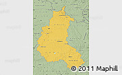
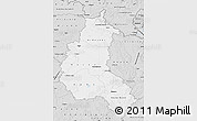
Political Map of Champagne-Ardenne, shaded relief outside
This is not just a map. It's a piece of the world captured in the image.
The flat political map represents one of many map types and styles available. Look at Champagne-Ardenne from different perspectives.
Get free map for your website. Discover the beauty hidden in the maps. Maphill is more than just a map gallery.


Base Map
- physical15

Physical map illustrates the natural geographic features of an area, such as the mountains and valleys.
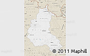
- political15

Political map illustrates how people have divided up the world into countries and administrative regions.
- satellite15
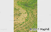
Satellite map shows the land surface as it really looks like. Based on images taken from the Earth's orbit.
- shaded relief15
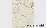
Shaded relief map shows topographic features of the surface. Hill-shading simulates the shadows cast by terrain features.
- political shades14

Political shades map use different shades of one color to illustrate different countries and their regions.
- classic style2
Classic beige color scheme of vintage antique maps enhanced by hill-shading. Champagne-Ardenne highlighted by white color.
- gray2

Dark gray color scheme enhanced by hill-shading. Champagne-Ardenne highlighted in white.
- savanna style2
Savanna green color scheme enhanced with shaded relief. Champagne-Ardenne is highlighted by yellow color.
- silver style2
Light grey color scheme enhanced with shaded relief. Champagne-Ardenne highlighted in white.
Outside
- political9

Political style for all areas outside of the borders of Champagne-Ardenne..
- cropped1

All areas outside of the borders of Champagne-Ardenne cropped from the image.
- physical1

Physical style for all areas outside of the borders of Champagne-Ardenne.
- political shades1

Political shades style for all areas outside of the borders of Champagne-Ardenne.
- satellite1

Satellite style for all areas outside of the borders of Champagne-Ardenne.
- shaded relief1
Shaded relief style for all areas outside of the borders of Champagne-Ardenne.
- single color1

All areas outside of the borders of Champagne-Ardenne filled with a single color.
Effects
No effects available for this map.
Options
- hill shading inside1
Base map enhanced by hill-shading.
- hill shading outside1
Outside map enhanced by hill-shading.
- shaded relief sea1
The depth of the waters represented by colors and enhanced by relief shading.
Maps of Champagne-Ardenne
Maphill is a collection of map images. This political map of Champagne-Ardenne is one of them. Click on the Detailed button under the image to switch to a more detailed map.
See Champagne-Ardenne from a different angle.
Each map style has its advantages. No map type is the best. The best is that that Maphill enables you to look at the same region from many perspectives.
Sure, this political map is nice. But there is good chance you will like other map styles even more. Select another style in the above table and see Champagne-Ardenne from a different view.
What to do when you like this map?
If you like this Champagne-Ardenne, France map, please don't keep it to yourself. Give your friends a chance to see how the world converted to images looks like.
Share this map.
Use the buttons for Facebook, Twitter or Google+ to share this Champagne-Ardenne, France map. Maphill is the largest map gallery on the web. But the number of maps is certainly not the only reason to visit Maphill.
Get free map of Champagne-Ardenne.
You can embed, print or download the map just like any other image. All maps are available in a common image format. Enrich your website with hiqh quality map graphics. Free images are available under Free map link located above the map.
Is there anything more than this map?
Of course, there is. It has been said that Maphill maps are worth a thousand words. That's certainly true. But you can experience more when you visit Champagne-Ardenne.
Be inspired.
Champagne-Ardenne has a lot to offer. It is not possible to capture all the beauty in the maps.
Discounts for hotels in Champagne-Ardenne.
If any of Maphill's maps inspire you to come to Champagne-Ardenne, we would like to offer you access to wide selection of hotels at low prices and with great customer service.
Thanks to our partnership with Booking.com you can take advantage of large discounts for hotels in all major cities of Champagne-Ardenne. Compare hotel prices in France, book online and save money.
Champagne-Ardenne hotels
See the full list of destinations in Champagne-Ardenne or choose from the below listed cities.
Hotels in popular destinations in Champagne-Ardenne
- Reims hotels »
- Troyes hotels »
- Charleville-Mézières hotels »
- Saint-Dizier hotels »
- Chaumont hotels »
- Épernay hotels »
- Sedan hotels »
- Vitry-le-François hotels »
- La Chapelle-Saint-Luc hotels »
- Romilly-sur-Seine hotels »
- Saint-André-les-Vergers hotels »
- Sainte-Savine hotels »
- Tinqueux hotels »
- Langres hotels »
- Rethel hotels »
- more »
Learn more about the map styles
Each map type offers different information and each map style is designed for a different purpose. Read about the styles and map projection used in the above map (Political Map of Champagne-Ardenne, shaded relief outside).
Political map
Political map shows how people have divided up the world into countries and administrative regions such as states, counties, provinces, municipalities and postal zones. Different colors represent different countries and regions, whereas different shades of one color represent their internal divisions.
The choice of color is not related to the characteristics of Champagne-Ardenne, colors are assigned to countries and regions randomly. The capital is marked with a black star inside a white circle. Squares and circles of various size indicate other major cities.
Shaded relief map
Shaded relief map shows landscape features, such as mountains, valleys and plateaus. Flat areas are smooth on the map, areas with steep slopes and mountains appear more rough. The above map of Champagne-Ardenne was created using a digital elevation model.
Zoom in to see major highways, railroads and airports. Railroad network is marked with wide dashed red and white line. Major highways are marked with wide white line. Switch to the detailed view for far more detailed navigation map with live traffic updates, GPS navigation and travel directions.
Geographic map projection
A map projection is a way how to transform points on a Earth to points on a map. This map of Champagne-Ardenne uses Plate Carree projection. The Plate Carree projection is a simple cylindrical projection originated in the ancient times. It has straight and equally spaced meridians and parallels that meet at right angles.
All projections from a sphere to a plane are distorted. The drawback of the Plate Carree projection is that it doesn't make an attempt to compensate for these distortions. For the general view of Champagne-Ardenne, this is not a significant problem. The detailed maps use the Mercator projection which preserves the shape of small areas better.
Facts
Popular searches
A list of the most popular locations in France as searched by our visitors.
Recent searches
List of the locations in France that our users recently searched for.
The Maphill difference
It's neither this political map nor any other of the many millions of maps. The value of a map gallery is not determined by the number of pictures, but by the possibility to see the world from many different perspectives.
Technology
We unlock the value hidden in the geographic data. Thanks to automating the complex process of turning data into map graphics, we are able to create maps in higher quality, faster and cheaper than was possible before.
Forever free
We created Maphill to make the web a more beautiful place. Without you having to pay for it. Maphill maps are and will always be available for free.
Real Earth data
Do you think the maps are too beautiful not to be painted? No, this is not art. All 2D maps of Champagne-Ardenne are created based on real Earth data. This is how the world looks like.
Easy to use
This map is available in a common image format. You can copy, print or embed the map very easily. Just like any other image.
Different perspectives
The value of Maphill lies in the possibility to look at the same area from several perspectives. Maphill presents the map of Champagne-Ardenne in a wide variety of map types and styles.
Vector quality
We build each map individually with regard to the characteristics of the map area and the chosen graphic style. Maps are assembled and kept in a high resolution vector format throughout the entire process of their creation.
Experience of discovering
Maphill maps will never be as detailed as Google maps or as precise as designed by professional cartographers. Our goal is different. We want to redefine the experience of discovering the world through the maps.
Fast anywhere
Maps are served from a large number of servers spread all over the world. Globally distributed map delivery network ensures low latency and fast loading times, no matter where on Earth you happen to be.
Spread the beauty
Embed the above political map of Champagne-Ardenne into your website. Enrich your blog with quality map graphics. Make the web a more beautiful place.
