

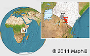
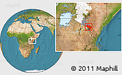
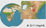
Satellite Location Map of LOITOKITOK, highlighted country, highlighted parent region
This is not just a map. It's a piece of the world captured in the image.
The satellite location map represents one of several map types available. Look at LOITOKITOK, KAJIADO, RIFT VALLEY, Kenya from different perspectives.
Get free map for your website. Discover the beauty hidden in the maps. Maphill is more than just a map gallery.


Base Map
- gray24

Dark gray color scheme enhanced by hill-shading. LOITOKITOK highlighted in white.
- savanna style24

Savanna green color scheme enhanced with shaded relief. LOITOKITOK is highlighted by yellow color.
- blank12

Simple black and white outline map indicates the overall shape of the regions.
- physical12

Physical map illustrates the natural geographic features of an area, such as the mountains and valleys.
- political12

Political map illustrates how people have divided up the world into countries and administrative regions.
- satellite12
Satellite map shows the land surface as it really looks like. Based on images taken from the Earth's orbit.
- shaded relief12

Shaded relief map shows topographic features of the surface. Hill-shading simulates the shadows cast by terrain features.
Outside
- satellite12
Satellite style for all areas outside of the borders of LOITOKITOK.
Effects
No effects available for this map.
Options
- hill shading inside12
Base map enhanced by hill-shading.
- hill shading outside12
Outside map enhanced by hill-shading.
- satellite sea12
Satellite images and actual aerial photos used for all water areas.
- shaded relief sea12
The depth of the waters represented by colors and enhanced by relief shading.
- highlighted grandparent region6
Entire grandparent administrative region highlighted by the color.
- highlighted parent region6
Entire parent administrative region highlighted by the color.
- show entire country6

The location of LOITOKITOK shown within the context of the entire country.
- highlighted country4
Entire country highlighted by the color.
Maps of KAJIADO
Maphill is a collection of map images. This image combines a satellite map with the globe centered on LOITOKITOK. Use the buttons under the image to switch to different map types.
See KAJIADO from a different perspective.
Each map style has its advantages. No map type is the best. The best is that Maphill lets you look at the whole area of LOITOKITOK from several different angles.
Yes, this satellite location map is nice. But there is good chance you will like other map styles even more. Select another style in the above table and look at the LOITOKITOK from a different view.
What to do when you like this map?
If you like this map of LOITOKITOK, KAJIADO, RIFT VALLEY, Kenya, please don't keep it to yourself. Give your friends a chance to see how the world converted to images looks like.
Share this location map.
Use the buttons for Facebook, Twitter or Google+ to share a link to this LOITOKITOK location map. Maphill is the largest map gallery on the web. The number of maps is, however, not the only reason to visit Maphill.
Free location map of LOITOKITOK.
This satellite location map of LOITOKITOK is available in a JPEG image format. You can embed, print or download the map just like any other image. Enrich your website with hiqh quality map graphics. Use the Free map button above the image.
Is there anything more than this map?
Sure there is. It has been said that Maphill maps are worth a thousand words. But you can experience much more when you visit LOITOKITOK.
Be inspired.
LOITOKITOK represent just small part of KAJIADO, but still it has a lot to offer and a lot to see. It is not possible to capture all the beauty in the map.
Discount hotel reservations.
If any of Maphill's maps inspire you to come to LOITOKITOK, we would like to offer you access to wide selection of hotels at low prices and with great customer service.
Thanks to our partnership with Booking.com you can take advantage of up to 50% discounts for hotels bookings in many towns and cites within the area of LOITOKITOK.
LOITOKITOK hotels
See the full list of destinations in LOITOKITOK, browse destinations in KAJIADO, RIFT VALLEY, Kenya, Africa or choose from the below listed cities.
Hotels in popular destinations in LOITOKITOK
Learn more about the map styles
Each map type offers different information and each map style is designed for a different purpose. Read about the styles and map projection used in the above map (Satellite Location Map of LOITOKITOK, highlighted country, highlighted parent region).
Satellite map
Satellite map shows the Earth's surface as it really looks like. The above map is based on satellite images taken on July 2004. This satellite map of LOITOKITOK is meant for illustration purposes only. For more detailed maps based on newer satellite and aerial images switch to a detailed map view.
Hillshading is used to create a three-dimensional effect that provides a sense of land relief. Shadows drawn on a map simulate the effects of sunlight falling across the surface of the landscape.
Map projection of the location map
The location map of LOITOKITOK combines two projections: the orthographic azimuthal projection for the globe and the simple geographic projection for the rectangular part of the map. Geographic projection has straight meridians and parallels, each degree of latitude and longitude is the same size over the entire world map.
The orthographic azimuthal projection is a perspective projection from infinite distance. It was already known to the Egyptians and Greeks more than 2,000 years ago. It gives the appearance of the Earth viewed from outer space. Only one hemisphere can be viewed at a time. The globe centered on LOITOKITOK appears more realistic than almost any other projection.
Facts
Popular searches
A list of the most popular locations in Kenya as searched by our visitors.
Recent searches
List of the locations in Kenya that our users recently searched for.
The Maphill difference
It's neither this satellite location map nor any other of the many millions of maps. The value of a map gallery is not determined by the number of pictures, but by the possibility to see the world from many different perspectives.
Technology
We unlock the value hidden in the geographic data. Thanks to automating the complex process of turning data into map graphics, we are able to create maps in higher quality, faster and cheaper than was possible before.
Forever free
We created Maphill to make the web a more beautiful place. Without you having to pay for it. Maphill maps are and will always be available for free.
Real Earth data
Do you think the maps are too beautiful not to be painted? No, this is not art. All location maps of LOITOKITOK are created based on real Earth data. This is how the world looks like.
Easy to use
This map is available in a common image format. You can copy, print or embed the map very easily. Just like any other image.
Different perspectives
The value of Maphill lies in the possibility to look at the same area from several perspectives. Maphill presents the map of LOITOKITOK in a wide variety of map types and styles.
Vector quality
We build each location map individually with regard to the characteristics of the map area and the chosen graphic style. Maps are assembled and kept in a high resolution vector format throughout the entire process of their creation.
Experience of discovering
Maphill maps will never be as detailed as Google maps or as precise as designed by professional cartographers. Our goal is different. We want to redefine the experience of discovering the world through the maps.
Fast anywhere
Maps are served from a large number of servers spread all over the world. Globally distributed map delivery network ensures low latency and fast loading times, no matter where on Earth you happen to be.
Spread the beauty
Embed the above satellite location map of LOITOKITOK into your website. Enrich your blog with quality map graphics. Make the web a more beautiful place.
